Backpacking Berg Lake, Mount Robson Provincial Park

Located in Mount Robson Provincial Park, the Berg Lake Trail is one of Canada’s premiere multi-day hiking trips and easily one of the top (easily accessible) hiking and camping destinations in all of the Canadian Rockies. The trail winds its way right next to the tallest mountain in the Canadian Rockies, Mt. Robson (3.954m high and UNESCO World Heritage site). It totals 23km one-way , gains 800 meters and includes 7 backcountry campgrounds, ranging from 5-23 camping spots at each location. At the top is the turquoise Berg Lake named for the large chunks of ice that calve from the 3 glaciers (Mist, Berg and Robson) that feed the lake.

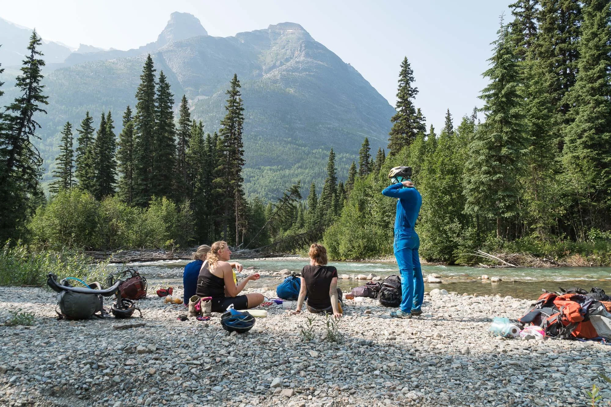
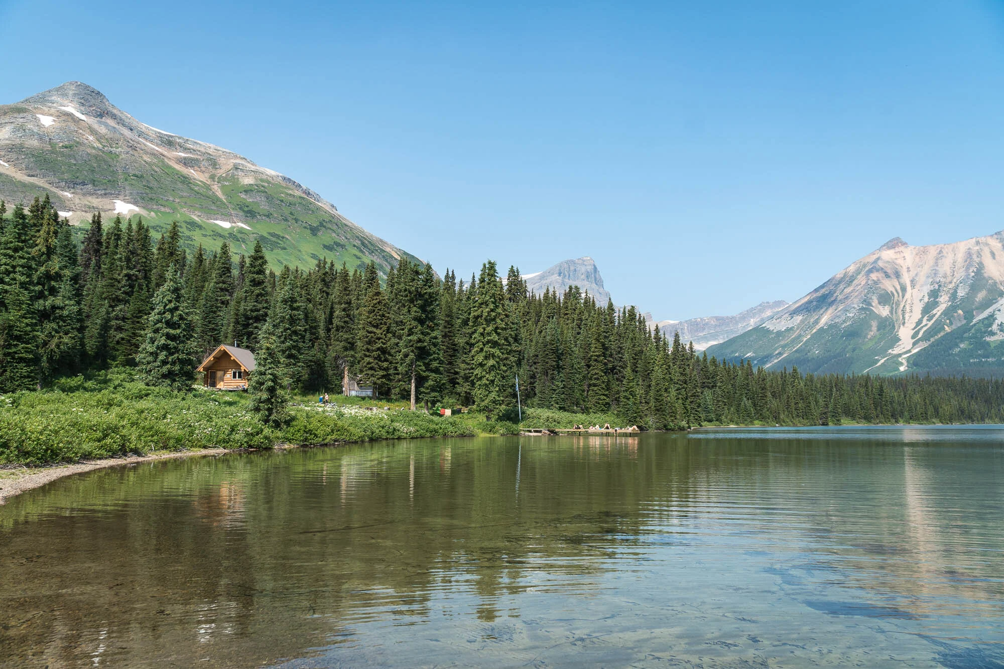
As the trail is high on the list of many backpackers it is permitted to avoid overcrowding and overuse. Luckily we planned early enough and obtained a permit a couple of months prior to our trip through the BC park system. We arrived early at the visitor centre to check in and receive our backpacking permit. The 7 campgrounds along the trail are Kinney Lake (7km), Whitehorne (11km), Emperor Falls (16km), Marmot (19km), Berg Lake (21km), Rearguard (22km) and Robson Pass (23km). We managed to get a spot at Marmot for two nights, so a big day lay ahead.

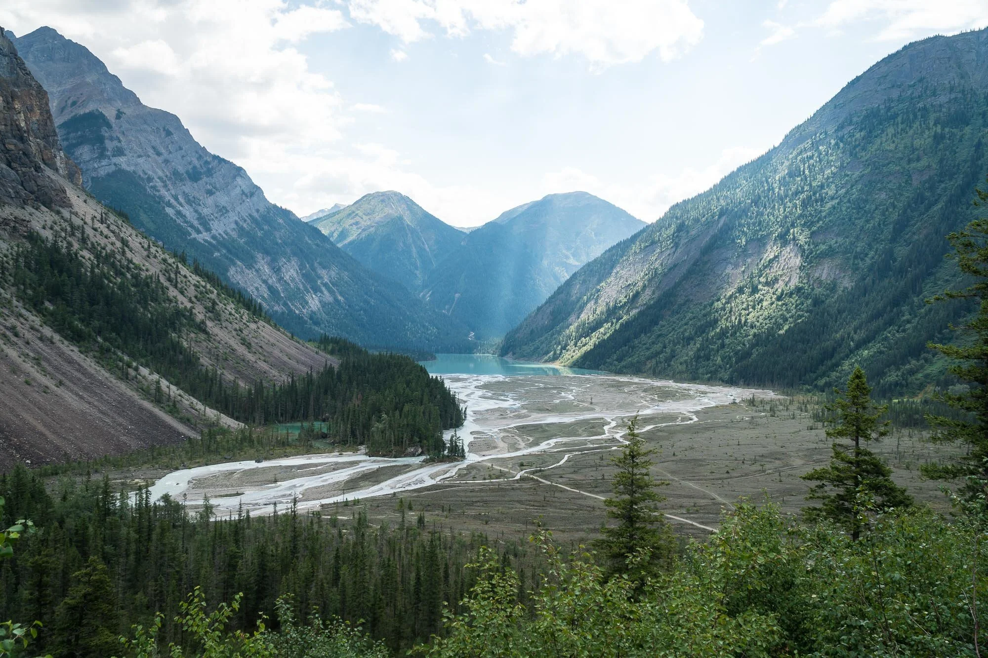
The first 4.5km is an old gravel road right next to Robson River that climbs steadily uphill but is never steep. We were fascinated by the microclimate here! In fact, the rainforest found in the Robson Valley is the world’s most extensive inland rainforest. Following the trail up to Kinney Lake we passed some massive red cedars and hemlocks that are over 1200 years old, 3.5m in diameter, and 45m high. As the first part of the trail is fairly easy we saw a lot of families, bikers and day-hikers with dogs making their way up to Kinney Lake. Leaving the lake behind the trail became much smaller and less frequented. From here we really started to gain elevation as we climbed into the Valley of A Thousand Falls. There were a few nice viewpoints for various waterfalls as we climbed the valley, but the most impressive was Emperor Falls at the top.

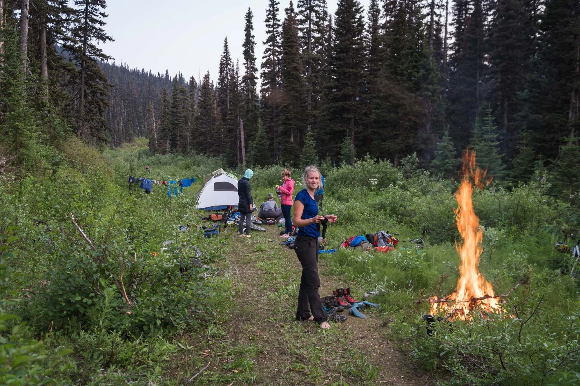
After this point the trail started to level out a bit, and soon the views began to open up as we approached Berg Lake. As the trail wound around Mount Robson, it got closer and closer to us. It’s hard to actually describe the overwhelming feeling of the whole scenery. 8 hours after we started our hike we were excited to reach Marmot Campground at the southwest end of the lake before the sun was setting. After we finished exploring and filtering water, we ate dinner and set up our tent. It didn’t take long until it got pretty cold, and we didn’t last long once the sun dipped behind the mountains.

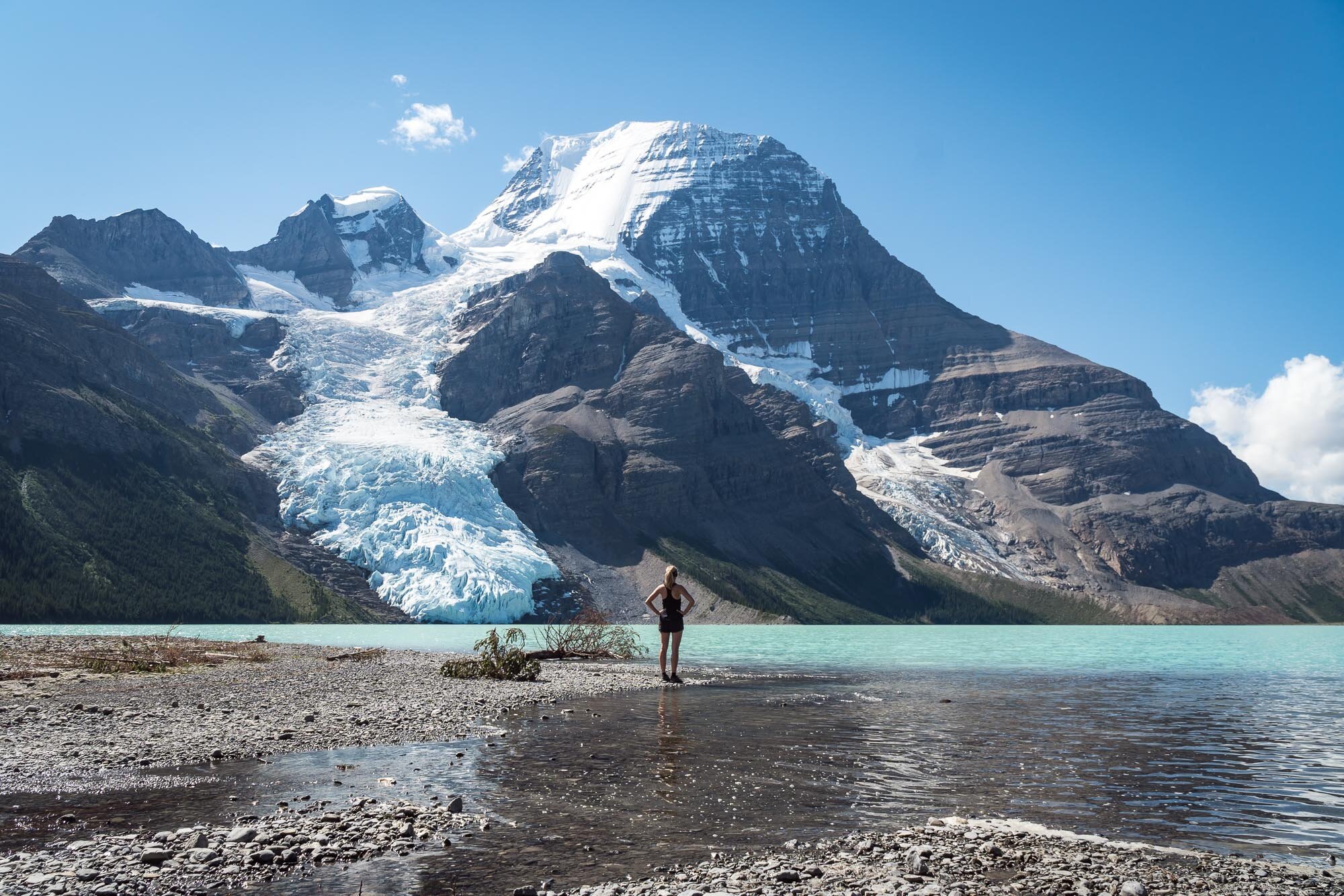
After a peaceful night we enjoyed our breakfast right at the lake and eventually packed up to head towards Snowbird Pass. As we started a little late we didn’t expect to do the whole hike and had another stop at Berg Lake campground to enjoy the scenery. Standing at the shore it’s hard to believe the first time you see it. Berg Lake and Mount Robson just look like they belong on a postcard.

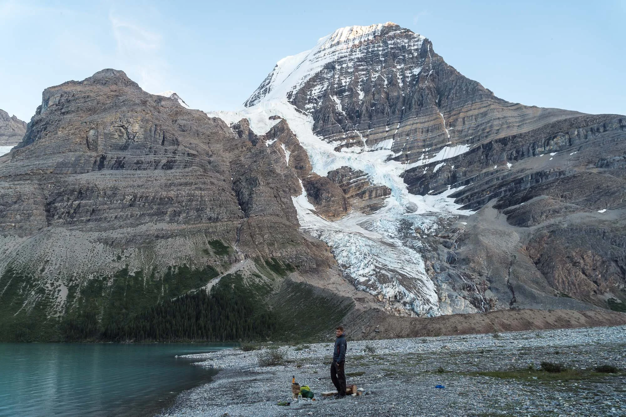
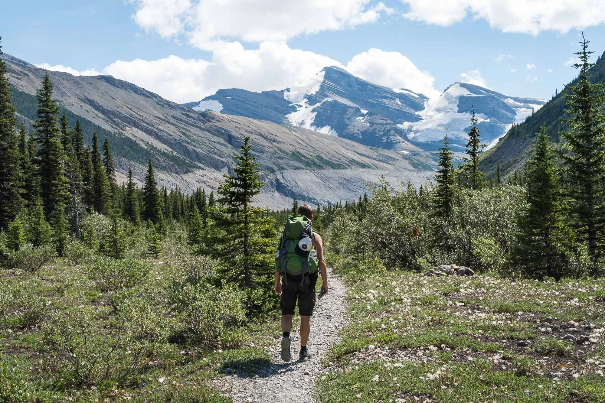
Still unsure how far we’d hike that day we continued through the meadows of the Berg Lake Valley, following the silt-laden water up to its source at the small, glacier-fed Robson Lake. The trail started to become more difficult as it climbs to the top of a glacial moraine. At this point, we were already at the far end of Robson Lake, amazed by the pure size of Robson Glacier up close and straight ahead. We met a group of hikers coming back down from Snowbird Pass and chatted for a bit to evaluate how far we could make it and if it was worth going all the way up. The answer was obvious. So there we went – another 23km with 800m elevation gain in difficult terrain, initially thinking we had tired legs from the day before.

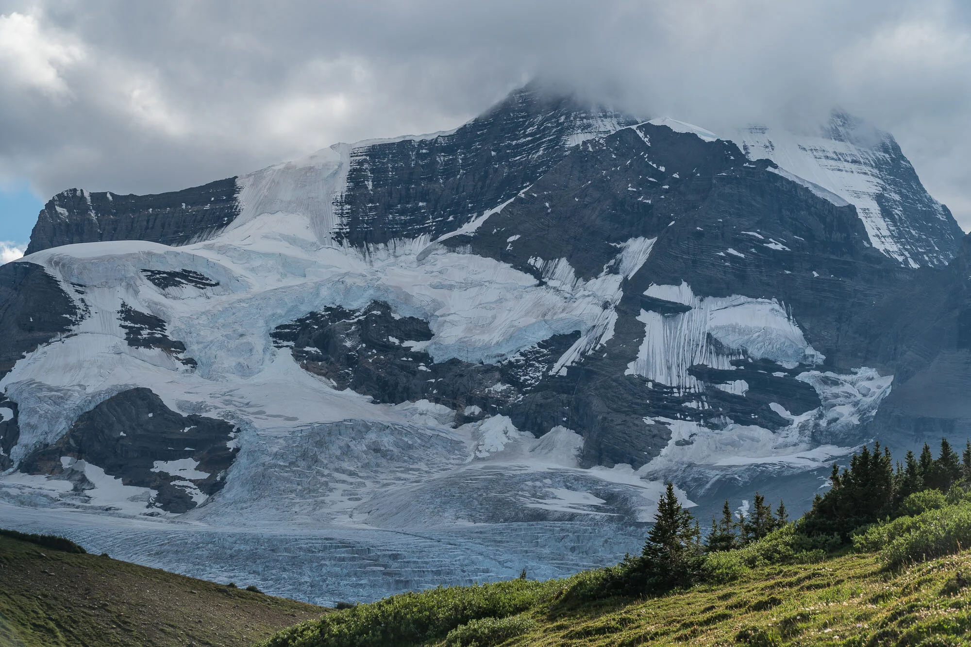
Climbing steadily we crossed a wide meadow with lots of active marmots and started our final push to reach Snowbird Pass in the late afternoon. The scenery was stunning and of course it was all worth it! We were awarded with spectacular views of the Robson Glacier, a beautiful alpine valley, and the enormous Reef Icefield beyond the pass. Looking across the vast expanse of ice separating British Columbia and Alberta, we took a well-deserved rest and quietly contemplated our achievement.

After the elation, the sobering reality of the long return hike to the campsite. We traced the same route back through the lush green valley, then descending the rocky mountain slope to the foot of Robson Glacier in the setting evening sun. Ten hours after we had set out on our trek, we returned to Marmot, had a quick dinner with our headlights on and snuggled up in our sleeping bags before the big descent the next morning. We were exhausted but the exhilaration of completing this beautiful and challenging route made this day feel like another spectacular adventure we’ll always remember.

Canoeing the Bowron Lakes Circuit

We’ve been looking into multi-days canoeing options in Alberta and British Columbia for some time already and stumbled across a couple of websites suggesting the Bowron Lakes Circuit as world-famous among canoers. Bowron Lake Provincial Park is a large wilderness area situated on the western slopes of the Cariboo Mountain Range. The Bowron Lake Canoe Circuit encompasses a 116 km chain of lakes and waterways, including 10km of connecting portages. A unique wonderland for canoeists and kayakers alike as it enables a 6- to 9-day journey through a remote wildlife refuge with an astonishing topographic diversity. The eastern side of the Bowron Lakes is actually part of the world’s only inland temperate rainforest (with Western Red Cedar trees over 1.000 years old and undisturbed forest stands much older than that) while the west features the rounded hilltops of the Quesnel Highlands. And the best of it all: You’ll end the circuit where you’ve started it! It is a perfect parallelogram of lakes, rivers and portages surrounded by temperate rainforest and imposing mountains. Truly a geographical wonder.

Our journey didn’t begin paddling, but with a 2.4 kilometer portage from the Park Registration Center to Kibbee Lake. Fortunately we had a decent canoe cart and handle system for an easy pull and once we reached Kibbee Lake we were quite optimistic about the other portages still to come. Kibbee Lake was a short but beautiful paddle through calm waters and forested areas surrounded by mountains. Only the the eerie sound of loons calling to each other perfectly complemented the silence. We instantly could feel we were in the middle of nowhere, isolated, no sounds or signs of any civilization, just the sounds of the kayaks making their way through the water and the dipping of the paddles in a steady rhythm. 

Before we were able to master all the different strokes, maneuvers and techniques to properly paddle a canoe, the second 2.0 kilometer portage had begun. It was steep, rocky and muddy, but we still managed to get to Indianpoint Lake on the same day, having our lunch break in an old wooden cabin close to the lake and finding a beautiful spot we would set up camp for our first night. We ended the day with a swim during blue hour, where we able to enjoy the beautiful moon from the water. We fell asleep to the comforting sound of raindrops on our tent, and waking up to look outside our tent to see a calm lake, a beautiful lush green forest of alpine fir and white spruce around us, encompassed by high serrated and partly cloud-covered mountain peaks. But there was no sense in waiting around to wait for better weather, we had a long way to go.

After packing up a wet camp we loaded the canoes and after a short paddle and another portage, we set off across Isaac Lake. At 38km, it was the biggest lake on the circuit and prone to wind and rain. It took us three days to paddle it and although the weather was generally getting better, the winds picked up with waves soon beginning to form during our second day. We paddled on, aware that whitecaps were now present across the lake, and every wave was breaking around the boat. A tailwind pushed us and the canoes started surfing on the waves. For a few minutes this was alright, but with even darker clouds and a thundery shower approaching from the North we eventually decided to seek shelter at a sandbank on the shore, waiting for the bad weather to pass. Hiding under a rain tarp the waves eventually died off and the situation eased.

For our last night at Isaac Lake we set up camp at its end where it transforms into the Isaac river. Even though we experienced fairly wet and unstable weather conditions during our first days, we enjoyed the simplicity of our schedule and turned our focus to those elements which drew us into such an excursion: Mountains, camp life, preparing our meals, sleeping for at least a full eight hours each night and viewing everything from water-level.

Our journey continued at the end Isaac Lake where it transforms into the Isaac river and the famous “chute” and “rollercoaster”. The chute is a narrow part of the river with rapids that quickly turn 90 degrees downstream. At the end of the chute the currents swirl together to form strong eddies that try to have their way with the canoe. After the chute the river straightens out and the rollercoaster begins. More rapids but at least these are of the straight variety and all you have to do is keep the canoe straight (in theory). Before entering the chute we once again felt very lucky to be on this trip with such an experienced group. Receiving clear instructions on how to approach the rapids and playing around in them, learning different maneuvers and techniques, we felt ready to face the white waters. And as the rapids began to seem bigger and bigger we cruised right through them with no struggle. We kept the canoes straight and as it spit us out we sweeped hard on the outside of the canoe to turn us right.

Below Isaac Falls the green, clean water of the Isaac River met the opaque silty water of the Cariboo River, which is glacier-fed. At the confluence the waters merged like stripes, and views of the caribou Glacier opened behind us. The scenery here was truly awe inspiring as we cruised down Cariboo River, but navigating it presented a new challenge. Littered throughout the river and on the banks were many deadheads and sweepers (so basically dead trees sticking in and out of the water). As the river is also very windy and silt-laden it can be a bit of a challenge to navigate around the corners and any obstacles we could see. That’s at least the excuse I’d like to use for why I haven’t taken too many pictures of the journey down the river :-) In the end, river canoeing was quite enjoyable and we eventually sneaked our way out of the river and into Lanezi Lake.

Lanezi Lake is the second largest lake on the circuit, and the scenery changed from silty waters with deadheads to majestic mountains and pine forests. By that time the weather improved a lot and we enjoyed a sunny (and almost too hot) 12 kilometer paddle across the lake, before passing through the narrows to Sandy Lake and ending a very long day on a beautiful, secluded, but also very buggy beach-side camp. West of here, the vegetation started to change a lot, from the darker cedar and hemlock forests in the wet, western slopes of the Cariboo Mountains, to the lodgepole pine and Douglas fir prominent in the circuit's western lakes. The mountains were gradually left behind, replaced by low marshland. At the same time, the skies have been blanketed by a smoky haze from forest fires burning across the southern British Columbia.

Below Sandy Lake we followed the Cariboo River and watched carefully on the left for the narrow entrance to Unna Lake, from where a trail leads to the roaring, 24 meter high Cariboo Falls. Another group of paddlers warned us that they’ve seen a bear on the trail, so we made sure to be very noisy and had our bear spray at the ready. A quick couple kilometers and we were at a raging wall of rushing water, luckily without running into any bears. And although there was so much raging water we could barely see past the mist, the water pumping through the canyon is something special to behold. From Unna Lake, we backtracked stream-upwards the Cariboo River to get to the mouth of Babcock Creek for another 1.2 kilometer portage. It was flat and easy, and we quickly made our way to Babcock Lake. We made short work of it and hit our second portage of the day. 400m later, we were onto Skoi Lake. The terrain was marshy and reedy. Another short jaunt and we were onto our final portage of the day, 400m to Spectacle Lake, where we would set up camp again for our last night on the circuit.

On our last day we made our way through Swan Lake and the Bowron River, where the shores became sandier and were lined with swamps and marshes. Knowing that our best chances for spotting a moose are in these kinds of settings we held our eyes wide open and as we traversed the flat waters we happened to see a moose cow and her newborn calf. We stopped in a reasonable distance and then drifted past, feeling lucky to have seen this, and not wanting to disturb her.

Eventually we emerged onto Bowron Lake, the final lake of our seven-day journey. Another hour and we would be back to civilization. We paddled hard as the head wind picked up, happy on our way with smiles on our faces, knowing we’ve just completed one of the world’s most renowned canoe trips.

DSC02297.jpg

A big thank you to Joyce, Bruce, Alyssa and Garth for letting us use their equipment and being the best canoeing companions we could have asked for. What a splendid time we had!   

Where the Trail Ends: Kakwa Provincial Park

As we just finished our canoeing trip on the Bowron Lakes Circuit we drove all the way up to Prince George, BC. Having the chance to wash all our clothes, give our bodies a well-deserved rest and gear up on groceries we soon felt the urge to head out again. We did a lot of research for our next destination: A service cabin at Kakwa Lake in Kakwa Wildlands Park / Provincial Park and Protected Area. Only 650 square kilometers in size with no road access, we knew it was supposed to be a very remote and hard place to get to. The park contains Mount Ida and Mount Sir Alexander, the two northernmost 3000 meter peaks in the Rockies. The latter is named after Alexander Mackenzie, who was the first person to cross North America, in 1793. The park straddles the Continental Divide, separating the drainage basins of the continent. On the one hand you have streams flowing toward the Gulf of California and the Pacific, on the other hand those flowing toward Hudson Bay and the Arctic Ocean.

To get there, we drove about 135km east of Prince George on Highway 16. We then turned north onto the Walker Forest Service Road, which would eventually turn into an old – and becoming overgrown – tote (mining) road that traverses the park from the McGregor River area. Due to rather adventurous road conditions with washouts and erosion along the way it took us about 4 hours to drive the entire 73km from Highway 16 to get close to the Bastille Creek bridge; the point where it gets impossible to continue by car and where we planned to switch to mountainbikes for the remaining 29km. As darkness started to set in and a mudslide was blocking our path we decided to set up camp even earlier (approximately 2km before Bastille Creek).

We prepared our bikes and panniers early the next morning, hoping to reach Kakwa Lake by dusk. As Kakwa is a Cree word for porcupine and porcupines can indeed be a problem in this area, we wrapped chicken wire around the vehicles to keep the critters away. After crossing Bastille Creek bridge we followed the trail close to the river for most of the way to Buchanan Creek. The McGregor River is very active along the first section, frequently cutting new channels and washing out sections of the old road. As a result new bypasses occur frequently and made numerous stream crossings necessary. We also encountered ankle deep mud and needed to push through many parts of this section which was especially hard with the trailers attached to our bikes. As if this wasn’t enough we were accompanied by large swarms of black and horse flies, so whenever we stopped for a rest we were literally eaten alive. But we didn’t let that dampen our enthusiasm.

We knew that the first 12km were supposed to be the worst section of trail on the way to Kakwa Lake. We eventually reached Buchanan Creek as a major creek crossing at 12km. The water here was thigh deep, so we played it safely and carried each backpack and pannier separately. A short time after the crossing a long and gradual climb began up to Wishaw lake (at 24km). During this section bushes were growing into the trail, making visibility difficult. We knew the trail was a major corridor for bears and other animals, so we used extra caution in areas where bushes resulted in poor visibility. The climb itself was taxing and the exhaustion set in, making it seem impossible to reach Kakwa Lake on the same day. It was almost nightfall when we decided to set up camp safely on the trail, still managing to get water and wood, start a fire and prepare food.

The next morning we woke up early to complete the final section to Kakwa Lake. The trail continued with a gradual climb to Wishaw Lake, where remains of the former mining operations in the park can be seen. Some sections of the trail were quite overgrown again, so we needed to make plenty of noise to avoid surprising any bears. After two more hours we arrived at Kakwa Lake. I must admid when I saw the lake for the first time it brought a big smile to my face. We couldn’t believe our eyes how beautiful and wild it was! We spent the rest of the day sitting on the dock right beneath the cabin, swimming in the crystal clear water, absorbing the views and just feeling free of any concerns in the world. What a rewarding experience. There were simply no other signs of human disturbance.

In 2007 two log cabins were built next to the lake. One is for the Park Wardens or Park Hosts who tend to the area. The other (service cabin) is for visitors and is first come first serve. The service cabin has four bunks and a loft that could sleep another four. There was a wood stove, table and counter space. We spent the evening chopping wood, preparing food, looking into hiking opportunities for the next day and generally being happy about what we’ve achieved.

While there are no marked hiking trails within the park, there are still many ways to explore the backcountry of Kakwa. It certainly adds a sense of adventure when most destinations require route finding skills. We relied on an excellent trail/route guide for this area written by John Vogt who has been to the Kakwa many times and is a wealth of information (http://www.kakwa.jjv.ca/).

Our plan was to go on a loop hike up and over Mount Ian Monroe and around to Babette Lake. The direct approach up Ian Monroe from Kakwa Lake involved a bit of bushwhacking through sections that were pretty steep, but the views from the top over Kakwa Lake in the east and Mount Sir Alexander in the west sure were worth the effort! From there the descent down towards Babette Lake was steep in some parts, but we were rewarded with wonderful meadows. On our final kilometers, a big thunderstorm suddenly rolled into the area, leaving us soaked and refreshed.

Returning back to the cabin we met the camp hosts for this season, Bev and Bill, who were a lovely couple from Vancouver with a great passion for nature. Together with them, we ate dinner in a cozy warm cabin. They were very kind and shared plenty of interesting stories of the area. That evening we looked into plant, bird, and butterfly identification, hoping to identify and learn more about the creatures we saw and photographed on the trip.

The ride back down was fun and rewarding until we reached the river crossing at Buchanan Creek, where we had to push our bikes through muddy and washed out parts once again. Eager to escape the black and horse flies, we made it back to our cars and on Highway 16 by nightfall.

In the end we could have easily spent weeks in Kakwa as we barely scratched the surface of the wonders to experience there. There are many other day hikes in the area, including the emerald green Lac La Glace +/- the steep route up to the glacier above it. Also, Corniche Pass to the north of Babette looked spectacular. Jarvis Lakes is probably a bit far for a daytrip but there is a cabin there as well. For keen explorers, Kakwa is really one of those special areas it’s hard to believe still exist. When doing research on the approach it has been said that the Kakwa is like what Jasper or Banff must have been like 100 years ago. It’s remote, under-discovered by summer visitors, and gets under the skin of those who are fortunate to experience its wonders.